Jaffna and East part of Sri Lanka
Jaffna
Jaffna Peninsula
The extreme north of Sri Lanka is Jaffna peninsula and it has attended by seven islets. They are Delft, Punkudutivu, Nainativu, Analativu, Karativu, Eluvaitive and Mandativu. Jaffna in contemporary Sri Lanka could be surmised as the perfect example of the Hindu-Tamil culture in Sri Lanka. The peninsula mostly surrounded by water, connected to the rest of the island by small strip of land. Its underground water used for drinking, agriculture and industry. Agriculture is an arduous task due to lack of water. Paddy cultivation is rain fed but only for three months during the northeast. Paddy cultivation is rain fed but only for three months during the northeast monsoon period, which occur normally October to January. The peninsula is consisting of fourteen administrative divisions. The total land area including inland water is 1030km2. The climate of Jaffna region considered Topical monsoonal with a seasonal rhythm of rainfall and the temperature ranges from 270C to 340C. Annual rainfall varies from 696mm to 1125mm, and evenly spread over the area. The total population of the district is around 700,000. Jaffna itself the estimated population is about 190,000 according to 2022 census. Agriculture and fisheries are the principal economic activities of the district. Over 60% of the work force in the district depends on agriculture for their livelihood. Their major cash crops are chili, onion, tobacco, potatoes and banana, which grow in large scale to meet the substantial portion of the national requirement. Farmers obtain considerable income from these crops. Further, fruit crops like mango, grapes and jack, and many varieties of banana also produced in large scale. Jaffna mango known as Karathakolombo is a mouth-watering variety that popular all over the country. Paddy is cultivated as mono crop in 85% of the paddy land. The balance 15%of paddy fields followed by vegetable cultivation and field crops every other season with the help of available irrigation. Vegetables are being cultivated throughout the year with the help of irrigation from the traditional dug wells call ‘Aandi linda’. Low country vegetables such as brinjal, tomato, long bean, okra, snake gourd, bitter gourd and other leafy vegetables are being cultivated and available throughout the year. Exotic vegetables like cabbage, beet, and beans, and are cultivated in large extent. It is an exciting experience to visit Jaffna market complex, where many Jaffna products are available.
The Palmyrah is a remarkable parm tree that plays an extensive role in the lives of the people of the Northern Province. It is the tree of life for Jaffna people, and there are 108 uses of the tree. The hard durable timber is valued for construction. The stalks use to make fences and the fiber for cordage and brushes. The leaves use for thatching, and weave mats, baskets, and produce fans, hats, umbrellas and writing material. The young shoots can be boiled, cooked as a vegetable or roasted and pounded to make a delicious meal. The kernel of the Palmyra fruit similar to lychees in teste, but milder in flavor and is edible. A sugary sap, call toddy, obtains from the inflorescence and ferment to make a mild intoxicate drink. Moreover, the toddy distills to make strong and hard intoxicating liquor call arrack. Toddy can also be concentrated to produce an unrefined sugar call jiggery.
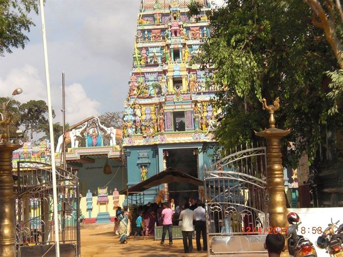
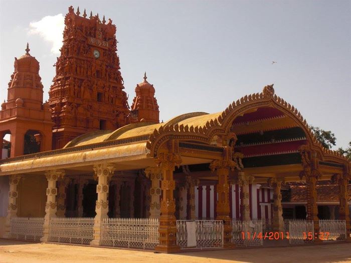
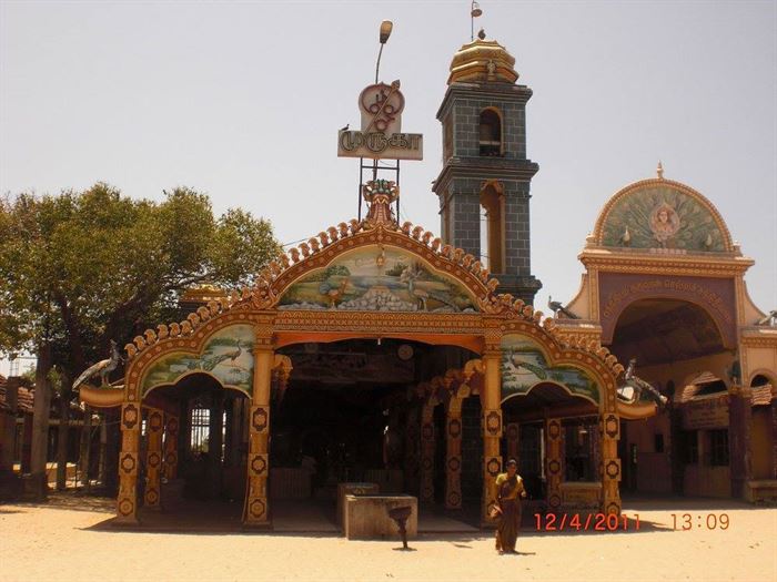
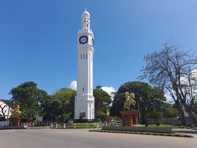
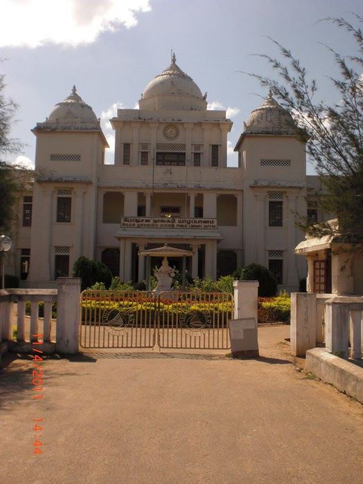
Imprtant monuments and places in Jaffna are; Nallur Kandaswamy Temple, Jaffna Fort, Jaffna Library, Naguleshwaram Hindu Temple in Keerimalai, Kadurugoda Temple site, Nagadipa Buddhist Temple in Nainativu, Nagapooshani Amman Temple in Nainativu, Delft Island, Dambakola Patuna and Casuarina Beach.
Eastern Province
Eastern province covers three districts in the island namely, Trincomalee, Batticaloa and Ampara, The land area is about 9961km2. It consists of coastal, dry plains and residual mountains, which sometimes rises more than 400m. Climate is dry and semi-arid and temperature varies between 270 to 340C. North East monsoon, which occurs during the period of November to March, brings more rain rather than Southwest monsoon, which occurs from May to September. It means that, when there is rain in the South and South West parts of the country during the Southwest monsoon, Eastern Province offer dry and ideal sea waves with warm water. However, one can guarantee warmer days than rainy. The population is around 2 million with a density of 200 per sq.km. Ethnic composition is also not similar situation as in the whole country. The province is comprised of Tamils, who are the majority (about 40% of the provincial population, Moors, Sinhalese, Burgers, Gypsies and indigenous people (Vaddas)) form the ethnic composition. They follow major four faiths, i.e. Hinduism, Buddhism, Islam and Christianity.
Tourist Attraction in Trincomalee
Trincomalee is situated in the Eastern part of Sri Lanka bordering the coastline.
Trincomalee Habour
Trincomalee is the 5th largest natural Habour in the world. The shoreline of a 33mile (53km) is adorned with unsurpassed natural beauty. Naturally, it is so situated that the mountain range surrounding the port helps the mariners to protect their sailing ships from both monsoons – southwest and Northeast. The hourbour was able to accomadate 500 war ships during the Second World War. According to the British, it is one of the “safest with superlative deep water; fathomless harbor”. Sometimes (2009) Whales use to swim in to the harbor! Now the mouth is blocked. Even after independence, British kept the Trincomalee harbor under the British Government due to the strategic importance of the Indian Ocean. The Sri Lankan Government acquired it only in 1957. Sri Lankan Navy head quarters are located there. There are several islands in and around the habour. Koddiyar bay is the main natural harbor located in a strategic position in the Bay of Bengal. There re various coves and bays such as Cod Bay, Yard Cove, China Bay and Marbl Bay, Little islands, scattered within the harbor. French Pass, (lager Sober Island) was used by French to escape from British. Sobar island is a wonderful spot for a picnic and other sites such as Dead Man’s cove, Marble Bay, Coral Bay and Black Bay worth visiting. There are recent records that wild elephants were swimming across these islands.
Fort Fredric
Portuguese destroyed Koneswaram temple and constructed the fort in 1624. The Dutch ousted the Portuguese in 1639 and captured the Trincomalee Town. In 1782, British drove Dutch away but the French fleet captured on behalf of the Dutch. Again, British recaptured it in 1795. Trincomalee is the England’s first fort in Sri Lanka. The British renamed the Fort in honor of Fredric, the Duke of York, in 1803. Kandyan King Rajasingha II (1635) built a fort in Trincomalee to attack Portuguese, it is called later as Fort ‘Osternberg’, which was the second fort Fredric. At present, administrative offices, an army platoon, and the Thiru Koneswaram Temple are located within the Fort premises. The wild herd of deer is an icon of the Trincomalee city.
Thiru Koneswaram Temple
Thiru Koneswaram is one of the earliest Iswarams or Saivite shrine in Sri Lanka situated on the Swami rock in Trincomalee. It is called as Tadchana Kailash – a place of worship. Historians believe that, Indian traders may have built the temple in the Pre-Christian Era. For them, Trincomalee was not only a port of call but also a place of trans-shipment of commodities with India and South East Asia. There are several statues of Hindu gods – Siva, Chandarsekaran and Ganesha found in the temple are regarded as archeologically unique. Especially, the God Gansehsa statue depicts the strength of an elephant and wisdom of a man. This temple attracts pilgrims from Sri Lanka and India as well. Pregnant women come here, make wows. Thousands of small decorative cradles, which are hung on the fig tree, can be seen. As there are many legends and folklore associated with Ravana, this temple has become an important holy destination in the Ramayana Trail.
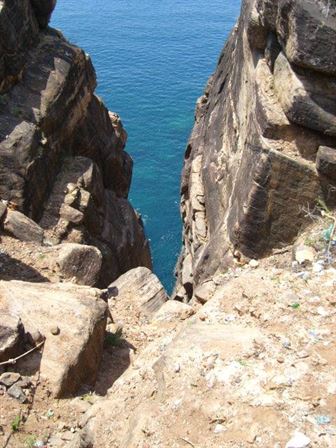
A little away from the shrine Thiru Koneswaram, a wide gap on Swami Rock called ‘lovers leap’, which relates a folklore of the pathetic love affair, a daughter of a Dutch official had with a young Dutch soldier. The ‘lovers leap’a sheer drop of the rock forms a panoramic view with crystal clear sheet of blue water with the dots of fishing boats and palm fringed golden sandy beach. The visitors never forget the experience of the fantastic view of the Indian Ocean, the rock formation, a Hindu Temple and the bird eye view of the city.
Kanniya hot wells
The Kanniya hot water springs located 10km from Trincomalee city, on the Trincomalee – Anuradhpura road. This is a cluster of seven hot water wells. People come and bathe for curative purposes as well as to have an experience of hot water bath because there are only a few hot water springs found in Sri Lanka. It is a very popular place among the domestic tourists and pilgrims. It has been recorded, that the Dutch in the 18th century AD, were the first to build an enclosure the well with wall and conduits. They believed in the therapeutic properties of the hot water springs. In 1817, according to the Major John Davry, there were seven hot springs that each recording a different temperatures and surrounded by a brick wall built by the Dutch. The local people believed that bathing would cure rheumatic pain and skin diseases.
Common Wealth War Cemetery
Trincomalee War Cemetery is one of the six Common Wealth War Cemeteries in Sri Lanka, located on the Nilaweli Road, approximately 6km from the city.
Historical records show that Trincomalee become the homeport of the British Royal Navy and submarines of the Dutch Navy after fall of Singapore during the second World War, which created the need for a service of cemetery. The army personnel in action or perished on board in the Indian Ocean were buried here. Today, Sri Lankan Ministry of Defense on behalf of Common Wealth War Graves Mission maintain the cemetery.
Whale Watching
Whale watching in Trincomalee is one of the few places in the world, where blue whale is sighted. The Best period for whale watching is April to August. International Whaling Commission (IWC) has declared Indian Ocean as a whale sanctuary. Twenty six of the world’s eighty species of whale, Dolphin and Porpoise have been recorded in Sri Lanka in waters including, great Blue whale, Hump Back and Sperm whales.
Pigeon Island
This is situated two hundred meters away from Nilaweli Beach. Pigeon Island is the only island National Park declared in 2003. It is also the only place, where Blue Rock Pigeon (Columbia livia) could be sighted. The water surrounded the island is regarded as an ideal site for snorkelers, it is approximately 5ha in extent and consists of pink granite out cropping that rise to the highest point; 20m and 12m. there is a second island closer to the main. Both islands are covered with marine sands and dead coral rubble. The National Park’s main boundary in measured at 1000m radius from the central point between the two islands and extends to the shore line of Nilaweili beach.
Batticaloa District
The district Boarders to the Sea, and Trincomalee, Ampara, Monaragala and Hambantota Districts. Predominantly Tamil Hindus live here and Christians, Muslims, Sinhalese, Buddhists and small groups of descendants from Portuguese and Dutch (call Burgers) consists the population of the District.
Batticaloa city is situated 314km away from Colombo on the eastern part of the country. The city is built on and around the island Puliyantivu and It is famous picturesque second largest beautiful lagoon and palm-fringed beaches. Much of the architecture and city layout, especially in the lagoon and water front areas have been influenced by the Dutch – British colonial period. Batticaloa’s rich heritage and culture provides a strong base for the development of cultural based tourism activities; the city is also famous for its prawn and crab production from the lagoon, which gives a city’s cuisine on its own character. Under the Kalladi Bridge and Navalladi Lagoon are the popular sports for Singing fish. It is said that, the sound like the tuning up of a string orchestra and can be heard from April to September. There are various ideas how that sound comes but none has proved.
Passikudah and Kalkudah
This sites located 35km northwards from the Batticaloa city. Passikudah and Kalkudah are two maiden beaches that are well known to holidaymakers and day visitors, who seek for sun, sea and sand. Passikudah and Kalkudah are ays situated close by, and protected by sea, resembles natural pools. One can walk more than 100m up to neck-deep level of seawater from the beach. Well-known array of accomadation ubits are there to have an unforgettable beach holiday. The ideal season is the period of European Summer. This area comprises of a wide verity of very rich ecological habitats covering the marine environment including coral reef and islands, mangroves and lagoon, shallow lake and dry forest. The area is rich in both birds and mammal population including elephant. There are also potential to view crocodiles.
Contact Info
